GNSS: Are we depending too much on electronics?
Daily planes and ships all around the world depends on several electronic navigational aids, but specially on Global Navigatoin Satellite Systems (GNSS). The most commonly used GNSS system, the American GPS, is installed in close to every commercial aircraft and ship. Some also use Russian GLONASS and European Galileo, and there are a few other with minor coverage. But they have one common major weakness, Eletronic Warfare.
In order for commercial aircrafts and shipping to find the fastest or most economic route to their destinations, they need to know exactly where they are at any time. How often to control the position depends on a series of factors, like where you are on your route, how close you are to any obstacles, how far from your destination, or how far you are from a change of course.
My experience is from shipping, but most of the prinsibles is valid for aviation as well. I will throughout this article assume that shipping and aviation can be treated similarly, though in most cases, aviation most likely will have more rigid requirements.
What is a GNSS?
A GNSS is a satellite based system, where satellites i Low Earth Orbit circles the globe in a pattern to give the necessary coverage. The exact type of orbit and the inclination depends on the system. These satellites sends out a radio signal that the receiver can listen to and calculate a relative bearing and/or distance, depending on the exact type of signal being sent out. The GNSS receiver will output a position when it reads enough satellites to calculate a position, and most receivers will also calculate a margin of error. For a ship to get a position, 3 satellites must be read, for an aircraft a 4th satellite is required as there is a height factor in the position.
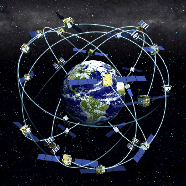
Global Positioning System, or GPS, is operated by US Space Force. It currently consists of 31 operational satellites in Medium Earth Orbit. The satellites sends a binary signal containing time and known athmospheric corrections. The position is calculated by reading phase shift and time differences, which gives a distance to the satellite.
GLONASS is the Russian equivalent to GPS. It currently contains 26 satellites in MEO. The signal is encoded and calculated in a similar way of GPS, though the accuracy is somewhat less (on the civilian code).
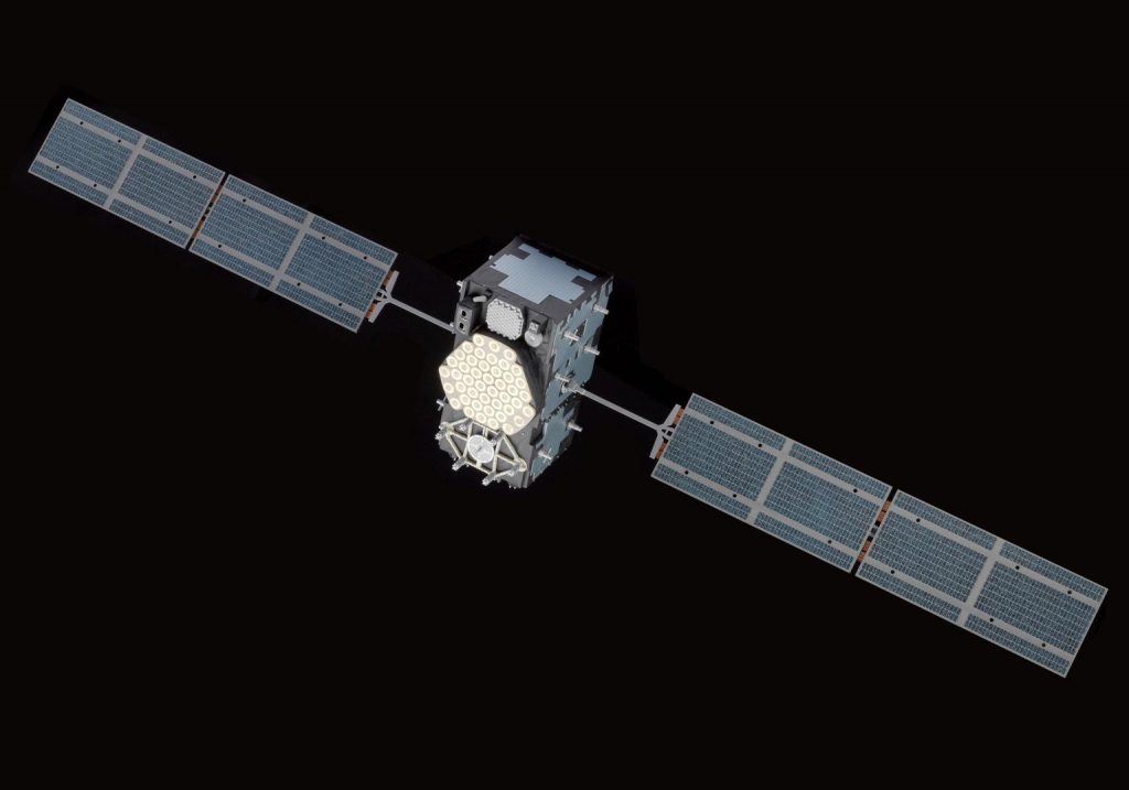
Galileo is the newest of the systems I will be covering here, though there are more. It is operated by ESA, the European Space Agency, and currently have 25 satellites in MEO, that is 24 active and 1 spare, their goal is to have 6 spare satellites. Galileo was launched as a civilian operated GNSS as both GLONASS and GPS has military applications, making them potentially unreliable for civilian use.
Other electronic positioning systems
GNSS isn’t the only electronic positioning system in use. Radio Bearings, LORAN C and electronic landing systems, and possibly others, are also available. These works in very different ways, uses different frequency bands, and ranges depends on the technology in use.
A common thing with these landbased systems is that range is fairly limited.
Electronic Warfare and GNSS
Electronic Warfare is the tactical use of any system meant to disrupt or mislead electronic systems. This can be in form of jamming (sending powerful radio signals meant to block the original signal from being received), disrupting equipment with EMP disabling or damaging the sender or receiver equipment, or spoofing with false signals.
The consequences of Electronic Warfare for civilian aviation and shipping is that you loose your position reference, which can result in grounding, colisions, or, for aviation, running out of fuel while looking for a suitable landing place.
How did they find the way without GNSS?
Electronic navigation have been around for almost as long as we have had radio, but civilian shipping and aviation havn’t relied on it for more than the past 50 years. At least until around year 2000, the old ways of dead reconing was still thought in Nautical Schools in Europe, but as ships mainly have sailed by GNSS, these skills have only randomly been practiced, and then most commonly in near coastal sailing, where bearings of landmarks or navigational buoys would give accurate positions.
The old way of dead reconing, where you took a partial position observation in the morning, and had to wait until noon to make the fix, the accurate position, you would have to ‘move’ the morning observation to the noon observation using as best you could your sailed course and distance.
Dead reconing was commonly done when accurate positions was not possible for long times, like during overseas voyages. Common tools for taking the positions during dead reconing was to take Celestial Observations every morning, noon, and evening. At dusk, solar noon, and dawn to be precise. Typical would be to take bearing and height of stars, planets, or the moon during twilight in the morning and evening, if you got more than one observation, you would have a fixed position. Then you would take the bearing of the sun at sunrise. Then you would take the height of the sun at solar noon, when the sun is at the highest. And finally observe the stars, planets, or moon during evening twilight. In order to combine these, you would need to know the direction and distance sailed between each observation.
ABC Tables
There are many ways to calculate a position from a celestial observation. One of them, that have been considered the fastest way to get an accurate enough position, is the ABC Tables. To use them effectively you need training, so basically, you should do such observations as often as possible to keep the skills ready. You need to know a few things about the object you are observing before bringing out your Sextant and doing the observation. First you need to look up some information in the correct date in the Nautical almanac, or equivalent publication. Then you need to do the observation and note the accurate time. And finally look up the tables.
My own experience
During my years at sea, I hardly touched the sextant. I would most likely have a hard time taking an accurate height unless conditions was very calm. I did for many years take bearings of stars to correct the compass, though.
Current events
As tension are rising in Europe, and the recent news of civil aviation being struck by GPS Jamming and GPS Spoofing, I fear that our dependency on GNSS are more and more becoming an issue, mainly for aviation, but also for shipping. It is now time for everybody working in aviation and shipping to dust off all those old skills. Younger pilots and navigation officers who do not have the experience should try doing dead reconing and celestial navigation just to be able to find their way back home in case their aircraft or ship is affected by these means of electronic warfare.


About The Author
Aun Johnsen
(He/Him) Aun aka Skippern is a long time geek, nerd, and h4x0r. Autodedact programer, map nerd, music lover, tech lover, retro. Former a master mariner, but forced ashore and turned IoT technician. Skippern is from one planet, consider himself dual nationality, lived in three countries, worked on four continets.